Over the past three years, I have mapped polluted communities, top secret military installations, and other health and privacy related locations using the Google Earth application for Windows.
The best thing about maptivism with Google Earth was the ability to save your map as a Keyhole Markup Language (KML) file, then share it on the web or embed it on a website using Google Earth's web browser plug-in. I had to teach myself to make a website using HTML 5 then learn the Google Earth API to be able to create ClimateViewer 3D, and now it is all coming to an end.
Google Chrome and Firefox are now killing Google Earth based websites:
the Earth API is built on a technology called the NPAPI plug-in framework, and recently, for security reasons, both Chrome and Firefox have announced they’re removing support for this framework. These security reasons, combined with dwindling cross-platform support (particularly on mobile devices), had made building applications that leverage the Earth API untenable for developers.If that were true, then why has Google already blocked the GE plugin in Chrome 64 bit on Macs?Therefore, after careful consideration, we have decided to retire the Google Earth API. Per our deprecation policy, the API will be supported until one year from today and will be turned off on December 12, 2015.
NPAPI is based on an old Netscape-era plug-in framework that makes installing plug-ins in web browsers easy. Google is stating that mobile browsers do not support plug-ins and security concerns have rendered the whole thing obsolete. ClimateViewer 3D’s Google Earth plug-in isn’t alone, several widely used plug-ins are dying along with it:
Starting in January 2014, Chrome will block webpage-instantiated NPAPI plug-ins by default on the Stable channel. To avoid disruption to users, we will temporarily whitelist the most popular NPAPI plug-ins that are not already blocked for security reasons. These are:NOTE: Already blocked by default for security reasons
- Silverlight (launched by 15% of Chrome users last month)
- Unity (9.1%)
- Google Earth (9.1%)
- Java (8.9%) SEE NOTE
- Google Talk (8.7%)
- Facebook Video (6.0%)
Browser Wars
Did you know Netflix runs on Silverlight? They thought they had eight years to prepare for this change, they were wrong:But since Microsoft announced the end of life of Silverlight 5 in 2021, we need to find a replacement some time within the next 8 years. We'd like to share some progress we've made towards our goal of moving to HTML5 video. source: HTML5 Video at Netflix April 15, 2013So what in the hell is going on? Keep reading that article and you will see your answer:
We've been working with Google to implement support for the HTML5 Premium Video Extensions in the Chrome browser, and we've just started using this technology on the Samsung ARM-Based Chromebook. Our player on this Chromebook device uses the Media Source Extensions and Encrypted Media Extensions to adaptively stream protected content. WebCrypto hasn't been implemented in Chrome yet, so we're using a Netflix-developed PPAPI (Pepper Plugin API) plugin which provides these cryptographic operations for now.PPAPI is turning out to be quite controversial, here is a short history:
On August 12, 2009, a page on Google Code introduced a new project, Pepper, with the associated Pepper Plugin API (PPAPI), "a set of modifications to NPAPI to make plugins more portable and more secure"Google's replacement for NPAPI would be a good thing, except Firefox said "No soup for you!"
"Mozilla is not interested in or working on Pepper at this time." May 2011Then Adobe jumped on the Google bandwagon:
In February 2012, Adobe Systems announced that future GNU/Linux versions of Flash Player would only be provided via PPAPI, although the previous release, Flash Player 11.2, with NPAPI support, would receive security updates for five years.In the end, these browser wars are going to be real interesting to watch. Now that we know that we are not alone in this struggle, we are searching for a replacement as Google clearly left us all hanging:
Google Earth has a proud legacy, which continues with the new Google Earth for Android, powered by a brand new renderer. 3D is in our blood, and while we can’t announce anything just now, we look forward to sharing more exciting product news in the future. source: Announcing deprecation of the Google Earth API
Replacing ClimateViewer 3D
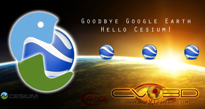
Since Google has not announced a replacement for the GE Plugin, the majority of Google Earth based websites are converting to the open-source Cesium 3D globe. Cesium is based on WebGL meaning no plugin necessary, all you need is an HTML5 browser and a 3D video card in your device. This new Cesium powered app will exponentially expand our ability to see real-time data and connect the dots in innovative ways. Turns out Raytheon has made a demo called Vega that does everything we are hoping to bring to the open-source community for free, here's what our new app should look like:I first discovered Cesium back in June of 2012 and have been closely following their progress.
Getting our Google Earth KML files into Cesium has been a long process that is now nearing completion!
ClimateViewer 3D will die, and from its ashes will rise a mighty phoenix: ClimateED (name subject to change).
In the following video you will see our crowd-sourced reporting app then you will see an image slider showing how we have already got those reports into our new system based on Node.js, Elasticsearch, Leaflet (for 2D) and Cesium (for 3D).
The Climate Editor
[the future of ClimateViewer 3D]Preview images of our work in progress, showing KML data in Leaflet.
P2P Geographic Situational Awareness System
On GitHub: https://github.com/about/netention JOIN THE TEAM! Use this form.Real-time decentralized global propagation, notification, and analysis tools for the most comprehensive, cross-domain, uncensored environmental dataset ever assembled - ClimateViewer (used in ClimateViewer 3D).
Discover how natural and artificial phenomena, from past to present, underground to outer space… might affect the quality and length of our futures.
FEATURES
Server- Finished* ..
- Somewhat Ready
- KML Import
- basics including Point geometry
- minify description HTML content
- HTML tokenization prevents indexing of HTML tags
- P2P Protocol* Publishing a query and getting a response
- Transfer layers and geodata (pull: receiver initiates)
- Web Server* Static files
- Geo queries* Circle (top left to bottom right of client's web map's = diameter of search, centered at center)
- Layer (metadata) queries
- KML Import
- TODO* Application runtime options* Enable web server* bind: host, port * Enable embedded ES* ES configuration * Enable local/remote ES's* list of ES addresses (host:port) * Enable peer node* bind: host, port * list of seed peer addresses (host:port)
- KML Import* remaining geometry types* Line, Multiline, Polygon, ... * Overlay
- verify that network links are correctly traversed
- styles and their resources available on static web server *
- Web server* Bound box query: more accurate for map display than circle (especially when the less square a box is)
- Installer script + documentation
- Seed Peerlist on Github
- Layer metadata* Semantic URI's - Apache GeoTK ISO's and NASA SWEET
- tags
- SensorML* ..
- More KML/GeoRSS/etc.. layers*
- NLP and Numeric Analysis of Measurements
- Document indexing (via Apache Tika plugin to ES)
- KML Import* remaining geometry types* Line, Multiline, Polygon, ... * Overlay
- Somewhat Ready
- Leaflet map
- dynamic HTTP GET AJAX update, triggering redraw of the layers
- Simple top-level layer legend of visibile item types with item count
- TODO* Websockets as preferred client/server communication protocol* Streaming client pull for view and interest (focus) updates * Streaming server push for alerts and notifications
- Layer tree* variable opacity
- activation of request for non-visualized (but possibly available) data types
- All metadata shown or clickable popup that shows, ex: URL and attribution source
- Icons and styling
- Item creation / editing (available in leaflet plugin)
- Representation of server equipment by its geolocation (geoip)
- Additional tilesets (available in leaflet plugin)
- Leaflet* Remaining GeoJSON types
- Overlay rendering
- Normalize Lat/Lon (it goes out of bounds if continue around earth)
- Cesium* ..
- Layer tree* variable opacity
Help us make The Climate Editor a reality
Imagine the Ferguson riots on The Climate Editor:- Draw a circle on the map around Ferguson
- Under search options, click:
- Tweets from Twitter (with image previews)
- Flickr photos (geolocated, live)
- YouTube videos (by tag, date, geotag)
- User tags (maps, posts by The Climate Editor community)
- any other source you can image
- Hit search, watch the live data appear as:
- Comment on, like, rate, and share any piece of data, marker, feed item, or graph point.
- Create your own or combine different data sets and save them to "My Layers" then share your collections:
- privately to your friends
- publicly on our server
- Or globally across all servers running The Climate Editor's Peer-to-Peer (P2P) network.


