50 YEARS OF U.N. TRACKING WEATHER MODIFICATION PROJECTS (1952-1999)
See the map in 3D on ClimateViewer Maps!
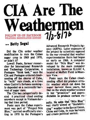
This documentary, in the form of a satellite map, traces the history of weather modification world wide between the years 1952 and 1999 as recorded by the United Nations World Meteorological Organization. This map includes data on the apparatus involved, agents applied and the techniques used in each event. It also includes both positive and negative results of some of the completed projects, funding sources such as government agencies and private companies. It even includes expert opinions and law cases on the topic in order for you to get a complete picture of the benefits and drawbacks of such programs. The apparatus, agent and characterizes data represents the first year of each program, any extended years of the program and in the case of US efforts lists the numbered NOAA documents for each extended year. The data involved in this map comes from the Register of National Weather Modification Projects 1989 through 1999 which are linked to this map.
Weather modification is one of those hot topics with possible negative and/or perverse unintended consequences dealt with by our sister web sites ClimateViewer.com/geoengineering/ and WeatherModificationHistory.com.
Unfortunately there are gaps in the UN data due to corrupted or missing pages. Fortunately some of the missing data was repeated in the other UN files in order to fill in the gaps.
Here are the original documents (2000-2006 are not in this map):
![Map of U.N. Tracking Weather Modification Projects (1952-1999) Map of U.N. Tracking Weather Modification Projects (1952-1999)]()
MAP SOURCE: UN World Meteorological Organization (WMO) Expert Team on Weather Modification
- 1989 • WMO Register of National Weather Modification Projects
- 1990 • WMO Register of National Weather Modification Projects
- 1991 • WMO Register of National Weather Modification Projects
- 1992 • WMO Register of National Weather Modification Projects
- 1993-1994 • WMO Register of National Weather Modification Projects
- 1995 • WMO Register of National Weather Modification Projects
- 1996 • WMO Register of National Weather Modification Projects
- 1997-1998 • WMO Register of National Weather Modification Projects
- 1999 • WMO Register of National Weather Modification Projects
- 2000 • WMO Register of National Weather Modification Projects
- 2001-2002 • WMO Register of National Weather Modification Projects
- 2003-2004 • WMO Register of National Weather Modification Projects
- 2005-2006 • WMO Register of National Weather Modification Projects
“Download PowerPoint Presentation: The Climate Changers and Water Wars: Technocracy, Geoengineering, and Replacing the Water Cycle” • Read the Article • Watch this Video on YouTube


